Fun In The Sun

With now quiet a few fishing trips completed for this year I can say I am happy with the boats performance and with my conferdence on the water growing each day I feel the bug coming on stronger and stronger with each trip. I would like to take a break now to let my body rest up before work tomorrow, so for now these fishing stories will have too wait.


From the Bay to two amazing beaches Brisbane and the greater Queensland has it all. What an amazing place too think an hour from your home you are at some of the best beaches in the world. For a change of scenery and a different type of adventure over the holidays I managed to get a little group together to head to Bribie Island. A day out four wheel driving and exploring a new destination was just what the doctor ordered and being able to share it with some friends made the journey complete.

DCIM103GOPROGOPR5143.JPG

Bribie Island is a easy hour drive drive North on the Bruce Highway but until your adventure can really start allow an hour an twenty minutes until you hit sand. I have been to beach side of bribie before with friends that have had four wheel drives so this trip i wanted to do something different. With minimal 4×4 experience to my name I thought it would be a good idea to warm up on the inland track to test the nerves and vehicles and boy was that a great decision.


The inland track also know as Northern Access Track is found by driving to the end of White Patch Esplanade. Coming off the Bribie Bridge, turn left at the first big round-about will find you onto Sunderland drive. Follow this till until it turns to White Patch Espl once past Banksia Beach you are almost there. MAKE SURE! as I found out, when four wheel driving your tire pressure must be lowered to make traction through the sand easier.

DCIM103GOPROGOPR5122.JPG

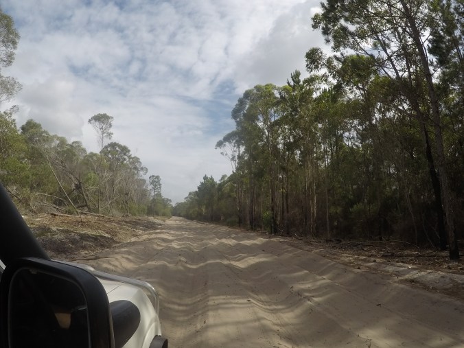
Turning the first few corners and getting through some soft parts in the sand all conformed my great decision in purchasing my four wheel drive. Along The Northern Access Track there are two camping sites, If you are thinking of staying the night make sure you check park rules and always make sure you have a camping and 4×4 permit. Once past Poverty Creek camp grounds, this will be your last opportunity for any toilet and rest stops so if your feeling like stretching the legs after the first bit of track I would highly recommend stopping in here. Following the Access Track allow another 40-50 min to get to The Fort Bribie day-use area, with a lot of bumpy tracks too follow through the centre of the island it make it a fun, slow trip that will get everyone in the car going. Once at Fort Bribie day-use are, get out and check the entry onto the beach just to make sure there are no hidden surprises waiting. Heading left and further up the beach you can only take you so far but with old remittences of buildings from World War ll scattered along the way it is a great way to see a little bit of history.

DCIM103GOPROGOPR5141.JPG

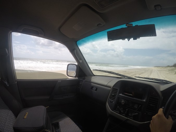
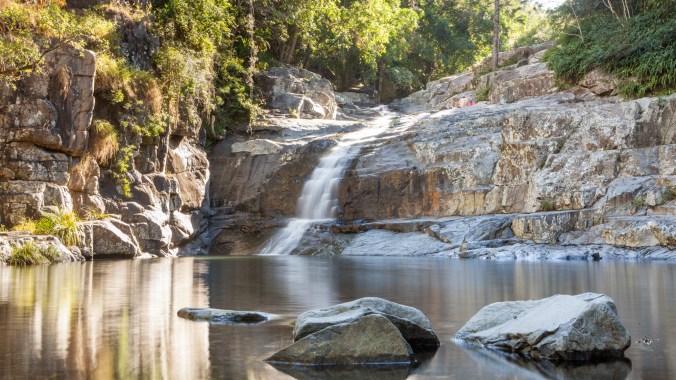
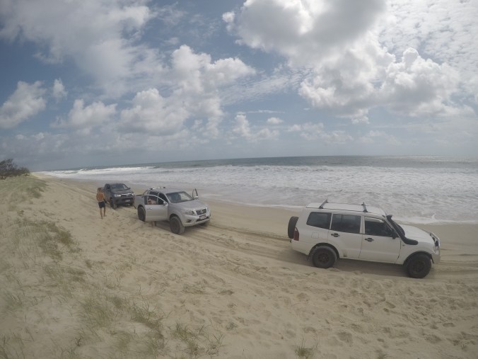
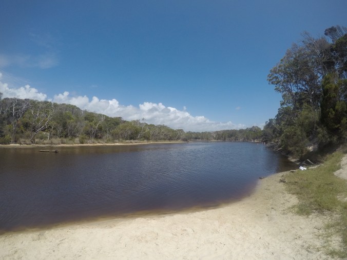
Our trip to Bribie island was purely for a drive and just to get out in the sun. We headed right as we got onto the beach and with high tide happening as we got on the beach it was a slow trip down the beach dogging in between waves as they rushed onto the sand. No need to fear, there are places you can pull into along the beach to get a way from the surf if it does get too high just always be sure that you can make it too the next spot JUST IN CASE! Managing to do our best too dodge the surf a stop in at one of the fresh water lagoons along the beach is the best place for a final stop before the trip home. These lagoons are great places for young and old a cool down if the surf is too ruff just be aware, with the murky water created by the tea tree it is hard too see the bottom. When walking through the water tread slowly, while we were there a girl had cut her foot on something sharp and left her with stopping the day early. I know it may seam funny to say, but if you want to be extra cautious take a old pair of shoes in with you, you might not be the most stylish on the beach but they can save you if you are worried.

DCIM103GOPROGOPR5175.JPG

Always remember once coming off the beach if you do not have a compressor on board, make the slow trip to the service station to add pressure back to your tires. With tires right too go and maybe a fresh drink or ice cream from the servo you can start your trip home or if your lucky enough you have camp spot on the island you don’t need to come back and face reality just yet. We had fun on our little trip around Bribie and i hope you do too. I hope to see you on the beach next time I’m at Bribie, till then…


Cedar Creek Falls


Whenever you hear Mt Glorious mentioned, first comes to mind is the beautiful drive along the ridge line from Mount Nebo to the valley that makes up Wivenhoe Dam region. For a different experience, I would like to take you to the other side of this ridge line to the base of the mountain where you can find a steady flow of crystal clear water filling rock pools as it goes and it is called Cedar Creek Falls.

cedar creek-1


Travelling

Getting to Cedar Creek falls is very simple as long as you do head to the right Cedar Creek falls when looking at a map. Make sure you are looking for Cedar Creek at Mt Glorious and not where maps will take you on your IPhone or android device and that is to Cedar Creek Falls at Mt Tamborine. Now this is sorted Cedar Creek Falls at MT GLORIOUS is a quick 35min drive from Brisbane’s CBD. As you reach Samford Village and drive along Mains Street, it turns into Mt Samson Road just outside the village, follow this road until you see the sign for the falls and Cedar Creek Road. If you go over the bridge just after the turn you have gone too far and you’ll find yourself in Closeburn. From the turn off onto Cedar Creek Road it’s simple, stay on this road for 10 minutes or until you reach the end, whichever comes first.


Food

If food is on your mind as you’re driving through Samford Village, I would stop for a bite at any of the local cafes or restaurants due to there will be no other options for food once you leave the village. In Samford Village, I would recommend the Samford Village Hotel where they have a beautiful grill open every day, a kid’s menu for under 12’s and a gourmet pizza selection enough to fill all your hunger needs. There is also a nice park to sit in for lunch and let the legs have a stretch out before getting to the falls.

When I head to Cedar Creek Falls and a nice juicy steak isn’t what I’m after, I’d rather pack a nice back pack lunch and once I am at the falls eat on the smooth rocks nearest to the car park, or if my stomach hasn’t started rumbling just yet, start heading up the creek and finding a nice quiet place at any of the rock pools along the way to the falls. Always remember if you do take your lunch PLEASE!! Take a bag for rubbish and put it in the bins provided in the car park when you leave.


Location

Now your tummy is full and energy is up, time for your Cedar Creek Falls adventure to begin. I would recommend taking a back pack with a towel, camera if you like to take some happy snaps along your adventure, and of course a water bottle. Even though the air is quite cool, the sun can still shine quite brightly through the trees and this can cause dehydration pretty quickly and it is a bit of a hike from up the creek to get back to your closest water source.

cedar creek mt nebo-9

Now that your back pack is sorted, put on some good waterproof walking shoes just in case you feel a bit adventurous and would like to take some more trickier routes across the creek. Yes, in some sections, your feet can get wet but it’s all a part of the experience. Setting off from the carpark I would allow a little over an hour to reach the main falls but with the many photo opportunities and swimming holes along the way this journey could take up to two hours especially if the kids are along for the journey.

The journey along the creek can fill your ears with the sound of birds chirping and the constant trickle of water as it flows down the creek along its drop offs and pools that build up. This sound is only broken up by people’s laughter and conversations as you pass different groups that have taken up waterholes as you make your way up the creek along the smooth flat rock sections. These sections are broken up with lots of rock hopping across and along the creek. You will also face some bigger boulders that will have to be climbed over to reach next sections but there are many foot holes in the side of the rocks to help you get over them.

cedar creek-3

A nice steady pace along the creek will find that you get to the falls without a problem but always remember if you ever need to cool down to continue your adventure, the water is right there, what are you waiting for… hop in and cool off.cedar creek-1 copy 3

Cedar Creek is a very simple place to get around you can either go up or down stream so there is no worry of getting lost just remember always follow the water and you’ll be fine. After your walk up the beautiful crystal clear water that makes up cedar Creek Falls, you will arrive at the falls and what, I think, is the best water hole of them all, with nice easy banks to get in and out of the water, and with the calming sound of the water rushing over the stone wall into the water hole, it makes for a beautiful relaxing end to your adventure. As you are sitting around and relaxing by the water’s edge, you may notice people walking further up and over the waterfalls edge. This continues further up the creek but I should mention this is a journey you need to be prepared for a little more than what you have experienced so far. If you feel like continuing on remember to pack extra supplies, but that will have to be a story for another time.

Tricks/ Tips

With a backpack, full of supplies and protective shoes ready Cedar Creek is an easy and fun place to get around.
This is definitely a place to visit through the summer months as the cool temperature moves in through winter and the water rushing from the top of the mountain can get quite chilly. I would recommend going more towards the end of summer this will give you a better chance of less people being in the area if you would rather have the place more to yourself, and the water temperature will still be quite nice, but with our summer I might mention we can have very severe and freak storms. This is a place where water levels and flow of the creek can change very dramatically. If this is noticed I would start making plans to head back to the cars as the creek can be very unforgiving in the case of flash floods.

If photography is your thing, and you are a nature lover, I’d recommend any time in the winter when you don’t have to worry so much about having to deal with large groups of people that flock to the location through the summer months. I’d also recommend, if possible, heading there just after some rain to see the creeks flow at full potential but remember to always stay careful and let someone know you’re going, you never know what can happen. Its better being safe than sorry.

I hope this article has given some good insight into what you need to know before you go to Cedar Creek Falls always remember mother nature is an amazing thing and that we should always respect it. Places like Cedar Creek Falls are popular destinations for young and old and will keep its natural beauty if we clean up after ourselves and do the right thing by it.